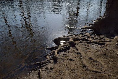
 |
| River Raisin in historic downtown Dundee, Michigan |
Thursday, April 15, 2021
River Raisin at the Old Mill Museum
Saturday, April 3, 2021
Red Cedar River
Fortune smiled upon us with a convenient and unexpected walk along the Red Cedar River today. I haven't visited this river in several years, I felt blessed to have it visit me in a way.
Saturday, March 27, 2021
An impromptu visit: River Raisin
I also brought my new anemometer along this time, which I set to read out in knots and Celsius because... why not? So I jotted in my notebook the local air temperature at 21 degrees Celsius and variable winds from the northeast at 2 knots. This is particularly indulgent for a data collector who was so pleased to find USGS records eight different data parameters at the gauge site (#04176500). For now, here are the two graphs showing flow and river height. Note that these graphs show the influx of water from the rain the evening of March 25-26. The pictures are from shortly before the rain.
Friday, March 26, 2021
Finally some rain!
Finally got a whopping 1.13 inches of rain yesterday and (mostly) last night. It's been fairly dry now for almost a month so it was a nice surprise this morning when I checked the rain gauge. I ventured a short trip over to the Huron River near Gallup Park and found a new spot on the south bank. Nothing much going on except the usual, ducks and geese and trumpeter swans and the like. It's becoming something of a series, this Huron River lately.
Friday, March 12, 2021
Creek to River
 |
| This is the creek and river I keep talking about |
Dove into map madness this morning.
Still trying to pull myself up and out of it but I thought I'd take a moment to share a map of the creek and river I keep talking about. The creek is the one that roughly follows the train tracks to the upper right. The Canal Street gauge site is at the bottom of the tiny triangle.
(Map snippet from the online interactive viewer at MapWashtenaw)
Tuesday, March 9, 2021
Ye olde Argo Dam
I just came back from an early afternoon walk by the Argo Dam. I realized it's been quite a while since my last gallivant in this direction. Things have changed!
and of course a snapshot from my favorite river bank near Canal Street:
 |
| water flow cubic feet per second |
 |
| river gage height at Canal Street site |
Monday, March 8, 2021
The river collection
The Huron River at the Canal Street site in Ann Arbor where most of the 'river near Canal Street' videos are taken is about 150 feet upriver from a USGS river gage site.
 |
| the original flow chart |
 |
| river height March 1-8 at Canal street site |
Saturday, March 6, 2021
Where waters meet
It was um, cold out there today mostly because of the wind chill. Still *technically* above freezing, but there were a few more car side photos taken this time around. This one I snapped while standing on a tall park bench to get a better view over the rocky shoreline.
 |
| Detroit River, facing Canada, moments before it meets the sea |
 |
| A view of Pointe Mouillee marsh from Hull's Trace landing |
Sunday, February 28, 2021
Sunday story of ice
Some highlights from the lower section of the Huron River. I traveled downriver and then worked my way back inland towards home. Perhaps most notable is that all areas of the river that are wide still have considerable amounts of ice. Of the lakes I passed, Belleville Lake is nearly 100% ice cover, and Ford Lake is at least 60% ice cover (unfortunately I missed the spot to turn off to get photos of Ford Lake). Beginning on the east side of Belleville Lake at Sandy's Marina, here is a short series to tell the story:
 |
| Belleville Lake, east end near Sandy's Marina |
 |
| Belleville east boat launch site (MI DNR) |
 |
| Huron River near Water Street, Ypsilanti |
Creek Life
A foggy mist out there this morning.
Just a trace of precipitation over the last day. I spent a few hours yesterday afternoon walking by the creek and river. The creek is working overtime doing its job. It's always so beautiful to see it functioning in top form. So often throughout the rest of the year it is a tiny, quiet tributary, but in the season for snowmelt, it shows off.As I was walking along the creek I thought about how fortunate I am to live so nearby that I can see it from my balcony. A two minute walk and I can quickly gather the status of its condition. Knowing this little creek will ultimately flow into the Huron River, and then on to Lake Erie, is such a lovely blessing. It is a very simple way to feel connected with nature and the Great Lakes, even an hour inland from the nearest shore.
Thursday, February 25, 2021
Driven to precision
A bit of a colder start this morning so the natural world can say a long goodbye to the ice. I finally revved up my Android Blackberry device to take some photos -- it is a phone I bought aftermarket and quickly realized it functions much better as a field camera than as an actual phone. Here are the results:
 |
| A view of the pond facing north-northeast |
26 degrees F at the airport on the south side at 9am this morning and 29 degrees F on the northeast corner of the city. I'm sure the variation is due in part to different sensors, but also the difference in elevation (about 70 feet farther up the hill on my side of town).


